The Mechintel Store
MechFlow V1 - Mechintel Dual Optical Flow + DTOF LiDAR Sensor Module for Drones (UART/I2C)
MechFlow V1 - Mechintel Dual Optical Flow + DTOF LiDAR Sensor Module for Drones (UART/I2C)
Couldn't load pickup availability
 Made in India
 Expert Support
 QC VERIFIED
 FAST PAN-INDIA SHIPPING
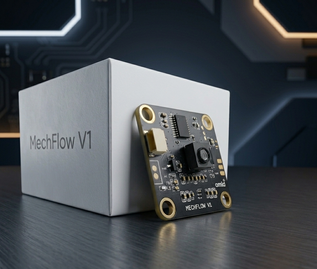
MechFlow V1 optical flow sensor board
Check Ardupilot Docs for MechFlow V1 here!
Datasheet: MechFlow V1 Datasheet
Test your MechFlow V1 sensor on the Mechintel Sensor Playground.
Overview
Achieve rock-solid position hold and sub-centimeter altitude stability without GPS.
The Mechintel Dual Optical Flow & DTOF LiDAR Module is an all-in-one vision-based navigation system engineered for micro-quadcopters, indoor drones, and autonomous mobile robots (AMRs). By fusing a high-speed downward-facing optical flow (PMW3901) sensor with a precision Direct Time-of-Flight (DTOF) laser rangefinder (VL53L1X), this module outputs real-time X/Y velocity vectors and absolute altitude (Z) data over a single UART interface.
Ideal for classroom STEM kits, university robotics labs, and custom ESP32, ArduPilot, PX4, and Arduino developer builds.
Key Features
- Zero-GPS Indoor Loiter: Fly indoors or in GPS-denied environments with precision hover capability.
- Integrated DTOF Laser Rangefinder: Eliminates altitude drift caused by barometer fluctuations or prop-wash, thanks to the ultra precise VL53L1X sensor.
- Universal Compatibility: Outputs MSP and Mavlink protocol, which allows native support for ArduPilot, PX4, and custom microcontrollers (ESP32, STM32, Raspberry Pi Pico, Arduino).
- Plug-and-Play Integration: Pre-calibrated optical alignment and integrated sensor fusion onboard—no complex optical lens alignment required.
- Ultra-Compact & Lightweight: Engineered specifically for micro-frames where weight and power consumption are critical.
- Dual Output Mode: Transmits synchronized X/Y pixel motion and distance data over standard serial (UART) or I2C/SPI protocols, which means one can directly access the attached sensors if required.
Technical Specifications
| Parameter | Specification |
|---|---|
| Optical Flow Sensor | PMW3901 - High-speed spatial tracking engine |
| Altitude Ranging (DTOF) | 0.05m to 4m (indoor/outdoor capable) |
| Output Data Rate | 100 Hz update frequency |
| Interface Protocols | UART (Serial) / I2C |
| Data Protocols | MSP/Mavlink |
| Input Voltage | 3.3V – 5.5V DC |
| Power Consumption | < 120 mA @ 5V |
| Operating Temperature | -10°C to +60°C |
| Weight | 8g |
| Mounting holes | 25x25mm |
| Dimensions | 28x28mm |
Pinout & Wiring Connections
| Pin Name | Function | Connection Target |
|---|---|---|
| VCC | Power Input | 3.3V to 5V DC |
| GND | Ground | Common Ground |
| TX | Data Transmit | Flight Controller RX |
| RX | Data/Command Receive | Flight Controller TX |
What’s Included in the Box
- 1x Mechintel Optical Flow & DTOF LiDAR Board
- 1x JST-SH 4-Pin Cable Assembly (Pre-crimped)
- 1x Quick Start & Firmware Documentation Access Card
Developer Resources
Access open-source C++ drivers, ESP32 Arduino libraries, and ArduPilot/PX4 setup guides on our official GitHub Repository.